Länge
Dauer
Gesamter Aufstieg
Zielgruppen
Ihre Suche ergab 42 Treffer


Amanaburch Tour
35287 Amöneburg, Deutschland
Eine Berg- und Talwanderung rund um die Basaltkuppe, auf der die Stadt Amöneburg thront.
3:10 h 253 hm 10,8 km leicht
Amöneburg Ostwand Geotop
35287 Amöneburg, Deutschland
Weithin sichtbar erhebt sich der 365 m hohe Basaltkegel der Amöneburg aus der Ebene und ragt über das Tal der Ohm hinaus. An der 25 m hohen Ostwand, die Sie mit dem Auto erreichen (Straße: Steinweg) sind flach liegende Abkühlungssäulen aus Basanit zu sehen. Wie ein scheinbar chaotisches...
_Regina-Sternstein_2023")
BilsteinFernsichtGeotop
63679 Schotten, Deutschland
Der 665,5 m hohe Bilstein, gelegen oberhalb von Schotten-Busenborn, ist eine beeindruckende Felsklippe und die höchste Erhebung eines Nord-Süd streichenden Höhenrückens.
Bonifatiuskanzel Geotop
36355 Grebenhain, Deutschland
Die Bonifatiuskanzel, eine Klippe aus Basanit, präsentiert sich als eine Felsnase von etwa 4 m Höhe und 3 m Breite über eine Länge von 10 m. Die Formation der Säulen ist besonders beeindruckend, und ihre Anordnung lässt auf einen möglichen Durchgang schließen. Die meist 5- oder 6-eckigen...
Burg Geotop
36355 Grebenhain, Deutschland
Wie eine sichere und massive Festung ragt die Felsformation Burg aus der Hochebene über dem Schwarzbachtal heraus. Blockschutt aus Basaltgestein und Löß bedecken die Hochebene um das Naturdenkmal. Die ovale Formation hat eine Größe von etwa 20 m Breite und 70 m Länge. Es handelt sich...
Christines Häuschen Geotop
36358 Herbstein, Deutschland
Der Fluss Schwarza, der südöstlich von Herbstein-Schlechtenwegen fließt, hat sich tief in die Vulkanite eingeschnitten und dabei einige beeindruckende Felsformationen freigelegt. Eine davon ist die Klippe Christines Häuschen, die sich am Südhang der Hardt nördlich der Salza befindet. Die...
Dicke Steine - Hansteingraben - Felsenmeer Geotop
35315 Homberg (Ohm), Deutschland
Der Stadtteil Nieder-Ofleiden in Homberg verfügt über mehrere interessante geologische Attraktionen. Etwa einen Kilometer östlich des Ortes befindet sich an einem malerischen kleinen Teich eine Schutzhütte, direkt neben den markanten Felsformationen namens "Dicke Steine". Diese...
Dicke Steine Geotop
36325 Feldatal, Deutschland
Der Berg zwischen Ulrichstein und Stumpertenrod, bekannt als Eckmannshain, erhebt sich auf 622 m Höhe. An seinem Nordhang befinden sich die Dicken Steine, eine Felsklippe, die bis zu 8 m hoch und 10 m breit bei einer Länge von 30 m ist. Die Säulen, oft nur 15-20 cm im Durchmesser, bilden...


Eisenpfad
63688 Gedern, Deutschland
23 km langer Rundweg mit Infotafeln zur Geologie und Kulturgeschichte über viele Wiesenwege
7:00 h 358 hm 358 hm 23,0 km mittel
Eiserne Hose Geotop
35423 Lich, Deutschland
Östlich von Lich befindet sich ein außergewöhnliches Geotop: eine Bauxitgrube. Die hier einst vorkommenden tholeiitischen Basalte wurden durch das subtropische Klima verwittert. Dabei blieben Eisen und Aluminium zurück und bildeten Laterit, während Kieselsäure sowie Alkali- und...

Erlebnispfad: Geopfad
63679 Schotten, Deutschland
Abenteuer Erdgeschichte - Einladung zu einer Zeitreise durch die Erdzeitalter
2:30 h 270 hm 7,0 km sehr leicht

Erzweg Mitte
35325 Mücke, Deutschland
Themen-Rundweg mit zahlreichen Infotafeln zur Geschichte des Eisenerzabbaues in der Gemeinde Mücke
3:00 h 243 hm 11,0 km leicht

Erzweg Nord
35325 Mücke, Deutschland
Eindrucksvolle Relikte der Erzförderung sind im Bereich des Erzweg Nord zu sehen
3:34 h 128 hm 13,7 km mittel


Erzweg Süd
Grünberg, Deutschland
Auf den Spuren des Eisenerzabbaus im vorderen Vogelsberg
4:00 h 194 hm 14,0 km sehr leicht
Felsenruhe Geotop
36358 Herbstein, Deutschland
Im Nordwesten von Herbstein, am Südhang des Kirchwaldes, befindet sich die Felsenruhe, eine bis zu 8 Meter hohe Klippe. Sie erstreckt sich in west-nordwestlicher Richtung und besteht aus feinkörnigem Basalt, der reich an Blasen ist und kleine Olivine sowie gelegentlich Klinopyroxene...

Felsentour Herbstein
36358 Herbstein, Deutschland
Entdeckungstour zu den geologischen Urspüngen der Region
5:30 h 278 hm 19,0 km mittel

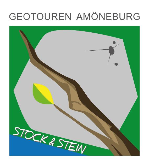
Geo-Tour "Stock und Stein"
35287 Amöneburg, Deutschland
Geologie hautnah: Rundwanderweg um den ehemaligen Vulkanschlot der Amöneburg
1:34 h 178 hm 4,8 km mittel

Geologie & Geistliches
Freiensteinau, Deutschland
Die Natur erleben-Dieser Wunsch erfüllt sich am Besten beim Wandern durch Wiesen, Wälder und Felder
3:29 h 196 hm 12,7 km leicht
 lädt kleine und große Kletterer ein")
Geotour Felsenmeer
35315 Homberg (Ohm), Deutschland
Geologische Besonderheiten und Naturdenkmale prägen den Rundwanderweg mit geologischem Schwerpunkt.
2:30 h 210 hm 7,0 km sehr leicht

GipfelTour Schotten
Schotten, Deutschland
Diese Tour führt über Bergwiesen und Wälder auf 4 Gipfel im Oberwald.
4:30 h 379 hm 14,0 km mittel
Große Kuppe Geotop
36323 Grebenau, Deutschland
Die "Große Kuppe" ist eine 12 Meter hohe Felsnase, die sich an der Westseite des Warthügels verbirgt, etwa einen Kilometer östlich von Grebenau-Reimenrod im Wald. Die Felskuppe besteht aus Basaltsäulen, die in einer markanten Meilerstellung angeordnet sind und eine Fläche von 30 x 20...
Hasenköpfel Geotop, Grillhütte und Rastplatz
36341 Lauterbach, Deutschland
Dieser aufgelassene Steinbruch unweit von Schloss Eisenbach ist ein beliebtes Ausflugsziel, denn er ist mit Ruhebänken und einer Grillhütte versehen. An den Wänden lassen sich schön die mittelstarken Basaltsäulen (bis 50 cm Durchmesser) erkennen, die senkrechte, teilweise geschwungene...
Heinzemänner Geotop
35329 Gemünden (Felda), Deutschland
Die Felsenformation "Heinzemänner" besteht aus dem Heinzemannskopf, einer 6 Meter hohen Felsnase und mehreren kleineren Felsen. Am Fuße der Klippe hat sich eine Ansammlung von Felsblöcken gebildet. Die Heinzemänner bestehen aus dunklem Basanit mit vielen kleinen Bläschen, in denen...
Hinterkippel Geotop
36399 Freiensteinau, Deutschland
Der Gipfel des Hinterkippel erreicht eine Höhe von 469 Metern. An seinem Westrand liegt ein stillgelegter Steinbruch mit einem Durchmesser von 100 Metern. In diesem Steinbruch, umgeben von einem kleinen Wäldchen, wurde Basanit abgebaut, der viele Olivinknollen enthält. Das Gestein...


Höhenrundweg
63679 Schotten, Deutschland
Dieser Wanderweg führt zu den Highlights rund um den Hoherodskopf.
2:00 h 83 hm 8,0 km sehr leicht
Horst bei Gunzenau Geotop
36399 Freiensteinau, Deutschland
Im ehemaligen Basaltsteinbruch "Am Horst" in Gunzenau kann man grünen Olivin im Vulkangestein bewundern. Die Bonifatiuskanzel auf 540m über dem Meeresspiegel wurde im Sommer 2007 errichtet und sollte nicht mit dem gleichnamigen Naturdenkmal und Geotop auf der Herchenhainer Höhe...
Kalkberg Geotop
36341 Lauterbach, Deutschland
Im verlassenen Steinbruch nordöstlich von Lauterbach-Maar befindet sich Muschelkalkgestein. Dieses Gebiet ist Teil des geologisch interessanten Lauterbacher Grabens, in dem jüngere Triasgesteine (Muschelkalk und Keuper) sowie Liasgesteine erhalten geblieben sind. Am Rand des Grabens ist...


Kreuz & Quer
Amöneburg, Deutschland
Der Rundwanderweg führt zu den geologischen und biologischen Highlights der Stadt Amöneburg.
2:59 h 40 hm 12,1 km leicht